THE DOLPHIN STUDY
Methodology
How the information in The Dolphin Study database was collected.
Long-term Bottlenose Dolphin Photo-Identification Study
A Long term photo-identification study is a non-invasive way to gain insight into communities of bottlenose dolphins.
The dorsal fin of a bottlenose dolphin – the part of the animal that presents itself when they surface to breath – becomes nicked and damaged. It is possible to identify individuals using these unique features.
Photographs of dorsal fins collected during boat-based surveys are archived with data associated with the sighting such as location, group size and behaviors observed.
Over time these data can provide insight into the number of dolphins in an area, how they are distributed, the range of individual dolphins, their association patterns and much more.
Read on for a more detailed account of how this study was conducted.
Surveys are conducted.
The sightings archived in The Dolphin Study database were recorded by naturalists in the course of their work aboard commercial eco-tours or by The Dolphin Study director aboard private boats donated by friends or supporters.
Pros to conducting surveys aboard commercial eco-tours: avoid the cost of outfitting boat and crew, lots of eyes to spot dolphins.
Cons: research competes with other priorities. Still, we have demonstrated that valuable sighting data can be successfully collected.

Naturalist James Livicarri photographs dorsal fins during an eco-tour near Marco Island.
We conducted surveys of Area One near The Big Marco Pass in every month of the year since 2006 (interrupted in the year of the pandemic). Surveys of the other three areas – Naples, Goodland and the near shore waters of the open Gulf of Mexico – have, until recently, been sporadic.
The Dolphin Study Survey Routes
Area One Survey Routes
For Years, Area One, Marco Island was the prime focus of survey work. Most Area One surveys were 3 hour trips that followed the route of the solid red line in one direction and then retraced the route in reverse. The broken orange lines mark occasional deviations from or additions to the principle route.
Circumnavigation Survey Routes
Surveys that involve Areas Two (the near shore waters of the open gulf) and Four (Goodland) often involve a loop that includes Marco Island, Kice Island and Cape Romano.

Dolphins are encountered
In deciding which dolphins to include in a “sighting” we generally followed the definition of a group as described by Dr. Randal Wells as “cohesive collections of conspecifics in a limited area (typically within several hundred meters), often engaged in similar activities and moving in the same general direction…” (1)
In the bays, channels and waterways behind barrier islands it was sometimes the case that more than one group of dolphins were within a few hundred meters of each other. We would treat these as separate sightings if they didn’t appear to be interacting or engaged in the same behavior.
Photos are taken
The recorder attempts to capture a high quality profile photograph of the dorsal fin of each dolphin present in the group.


I use a Nikon D7100 with a 200-500 mm lens during surveys. With the 500 mm telephoto it is possible to get usable photos of dorsal fins from a considerable distance.
Data is recorded
The sighting sheet is accessed by internet connection to The Dolphin Study database and the following categories are populated.
Sighting
Time
Location
GPS Coordinates
Depth
Tide
Comments
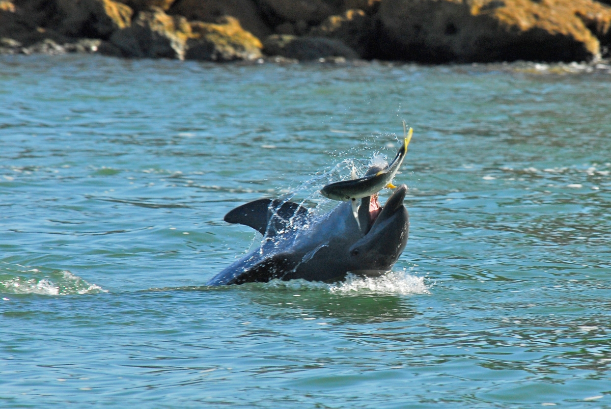
Behaviors
MILL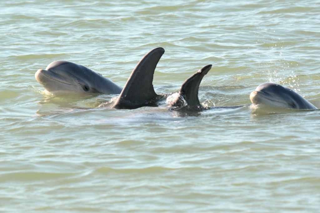
PLAY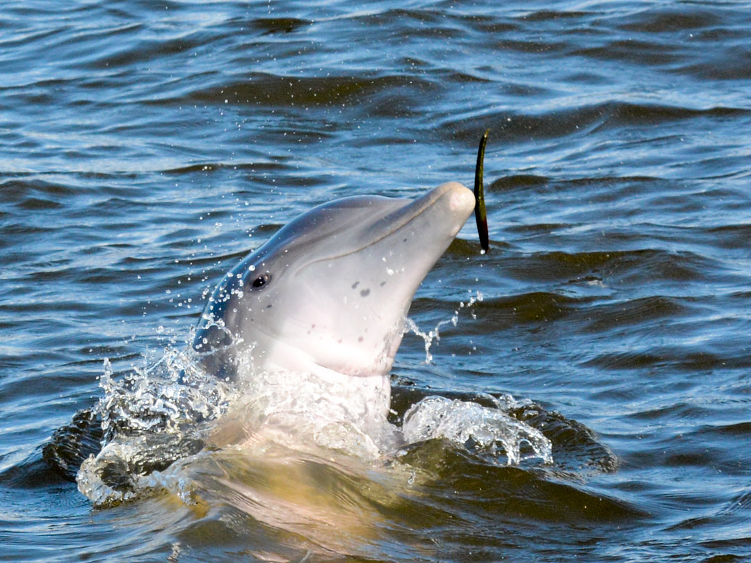
CHUFF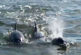
PROBABLY FEED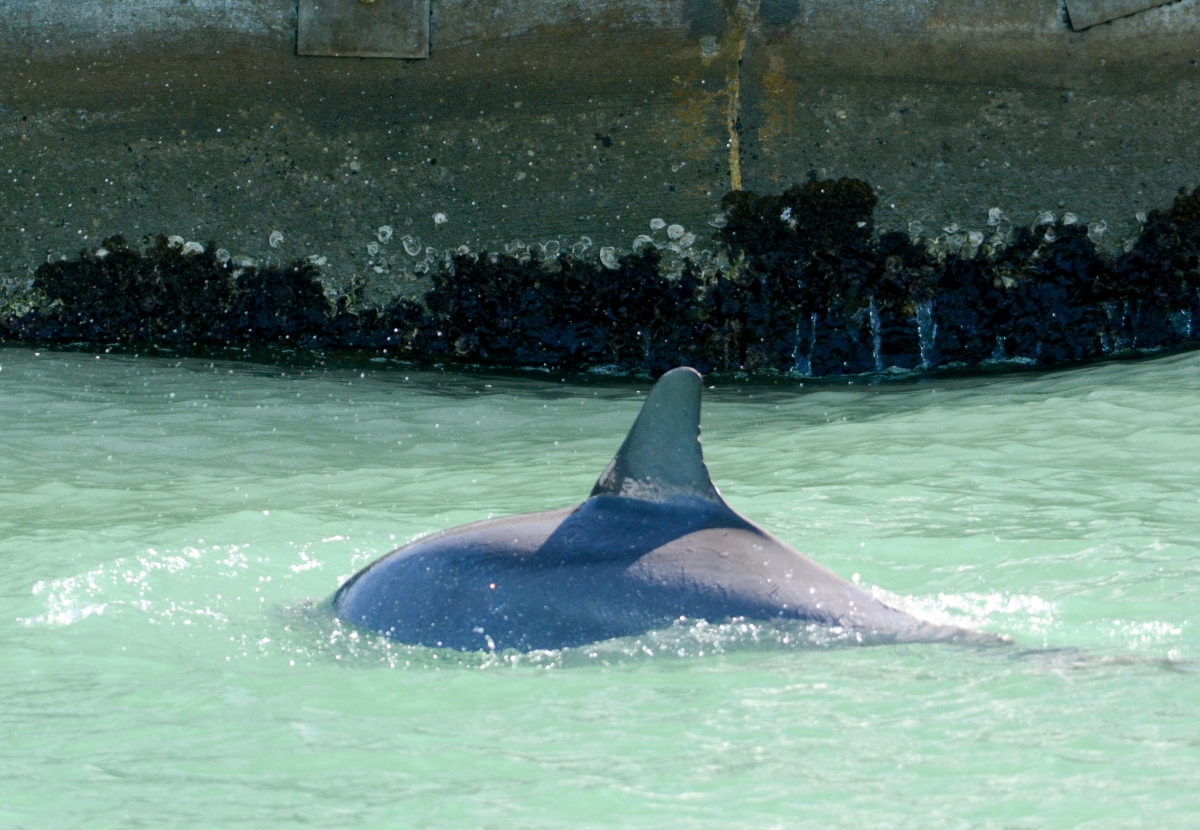
REST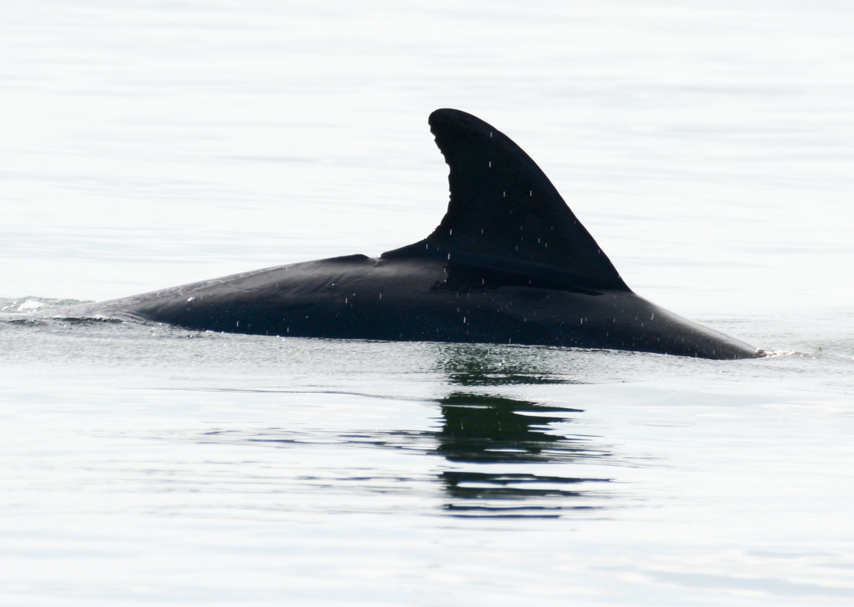
LEAP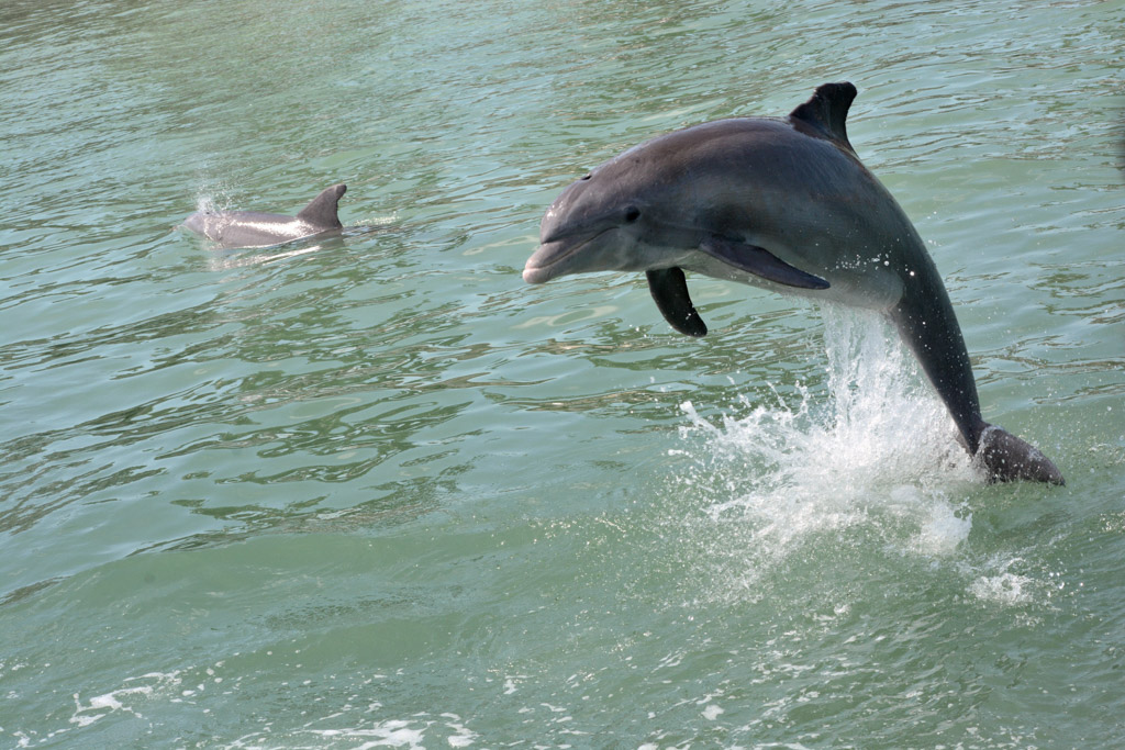
SOCIAL 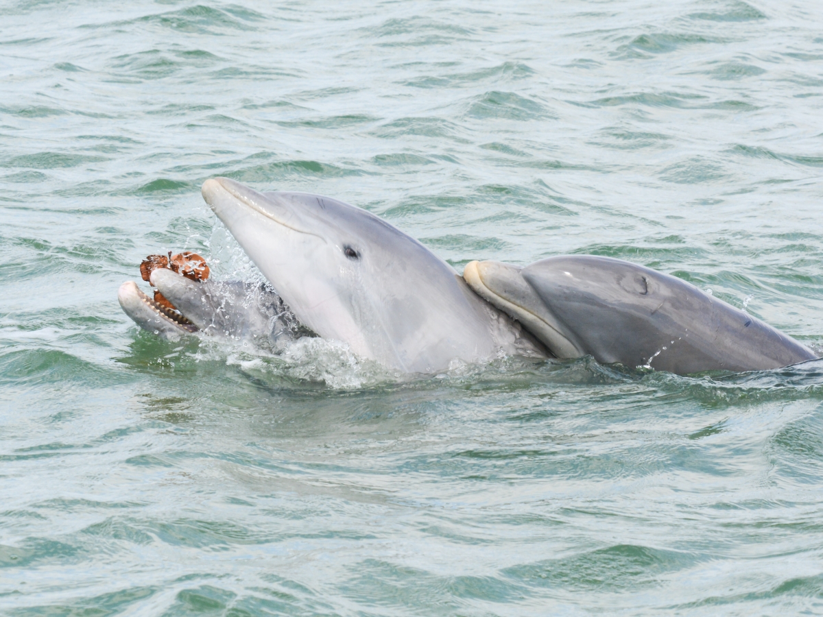
SHADOW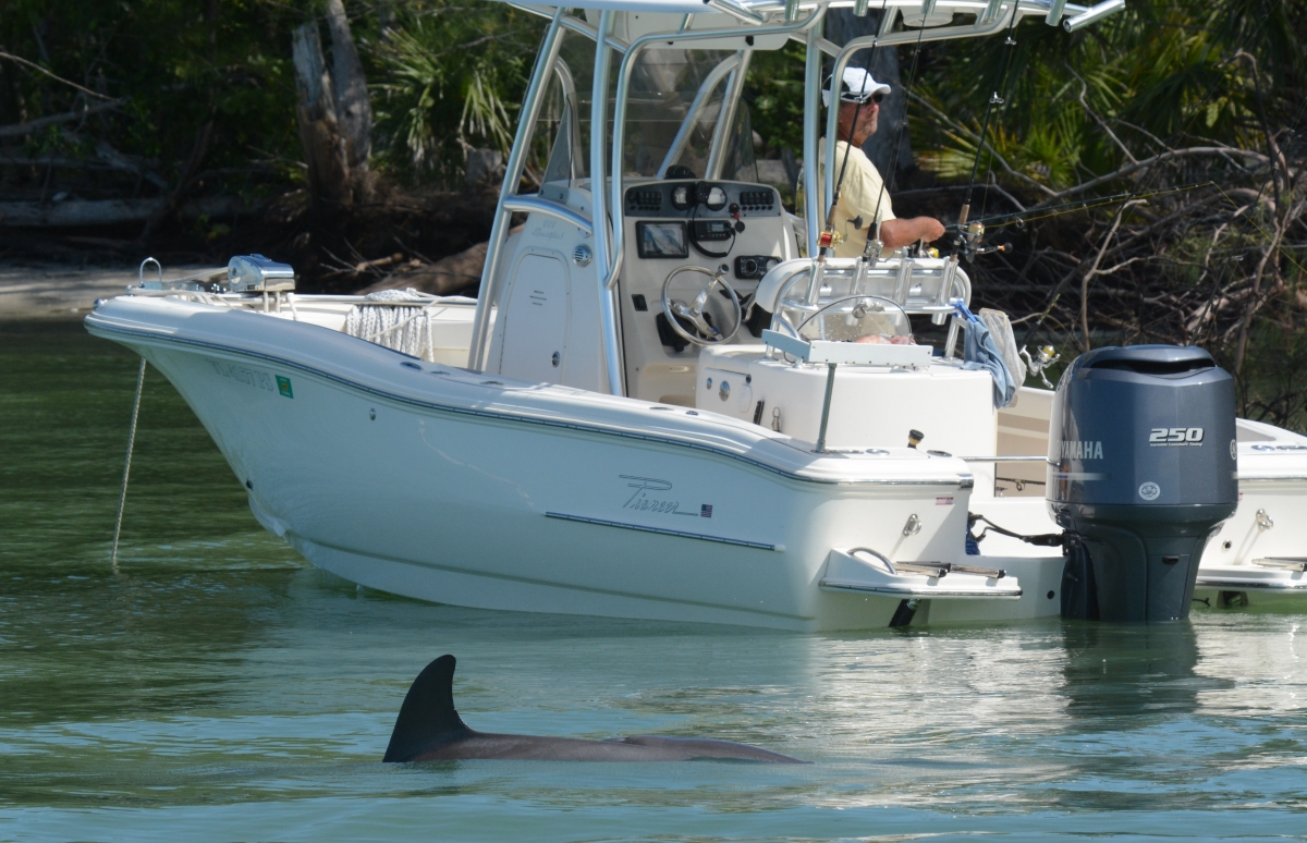
TRAVEL
TAIL SLAP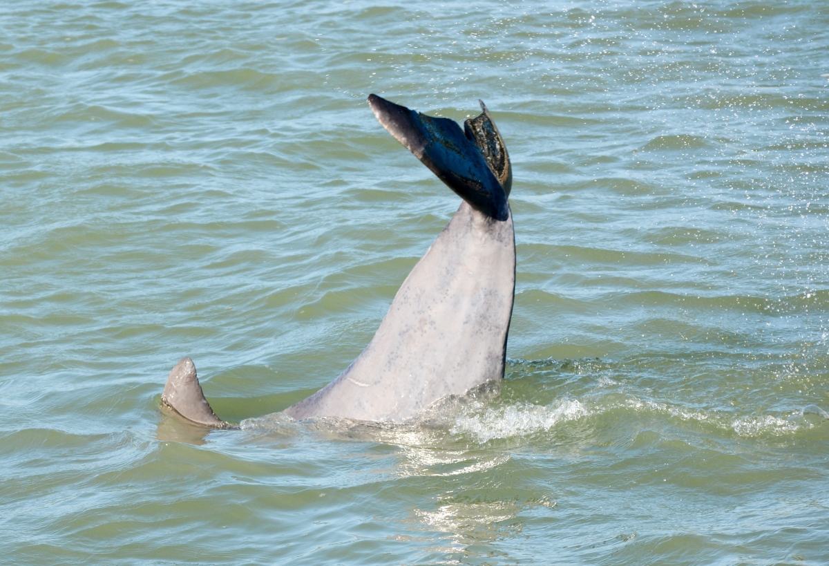
WITH BOAT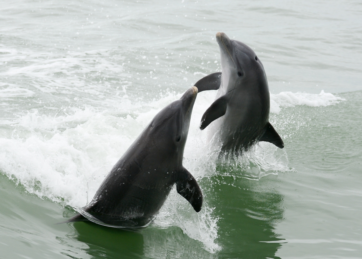
Photos are analyzed

A lot of photos of varying quality are generated during a survey. These photos are processed under the supervision of one or more cats. The work of photo analysis involves evaluating all photographs associated with each sighting. Those that do not include dorsal fins, are out of focus, or otherwise unhelpful in identifying the individuals present are deleted.
After this initial review each fin photo is cropped to 4/3 aspect ratio to include only the dorsal fin. Repeats are again weeded out, leaving the best photo of each individual the recorder was able to capture.
These photos are then uploaded to the Dolphin Study database, added to the corresponding sighting sheet.
Dolphins are Identified
The last step is to compare each of the final dorsal fin photos to those in The Dolphin Study catalogue in order to determine the identity of the dolphins present in the sighting.
There are over 500 unique dorsal fins in The dolphin Study catalogue. To aid in identification of photos captured during a sighting each dorsal fin that has been added to the catalogue is categorized using a variation on a system developed by Kim Urian, a Research Analyst at Duke University and curator of the Mid-Atlantic Bottlenose Dolphin catalogue.
The Dolphin Study Dorsal Fin Catalogue
The fins are first categorized by whether their fin is “Atypical” or “Intact”. Within the Atypical category are six subcategories:
ATYPICAL FINS
BEND 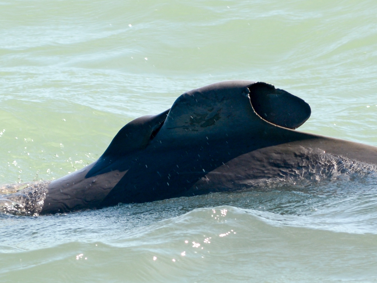
LEAD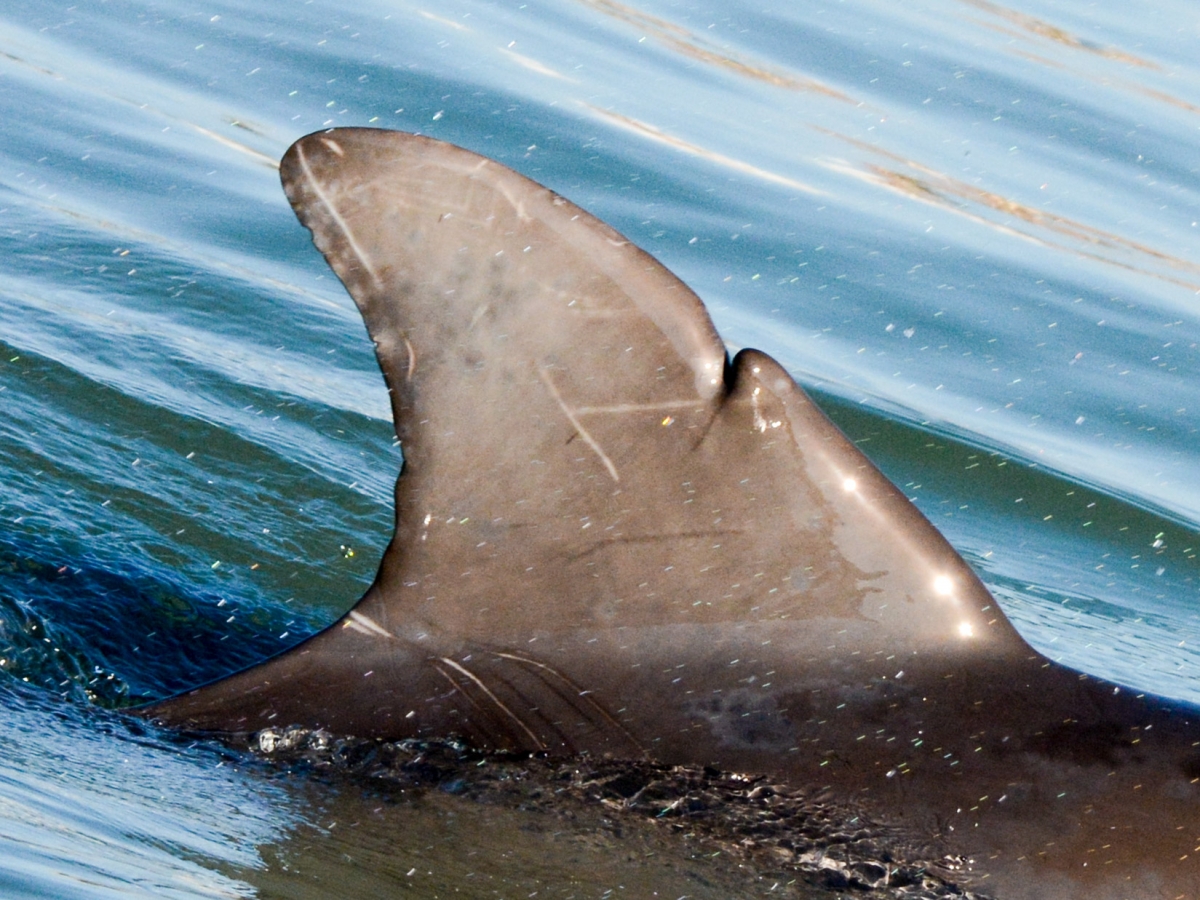
MISC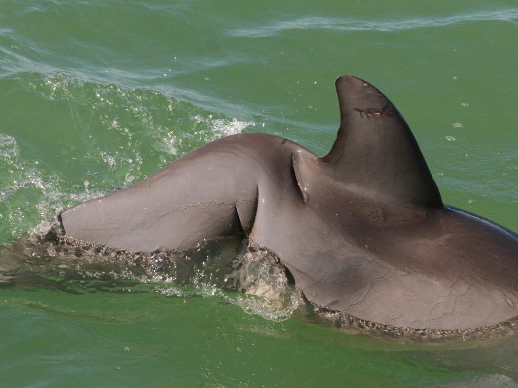
MISSING TOP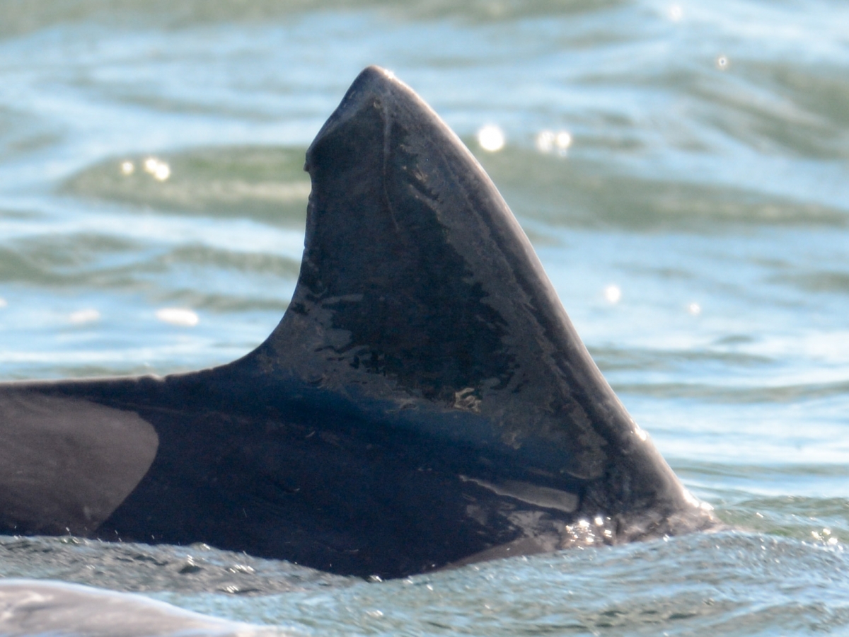
PEDUNCLE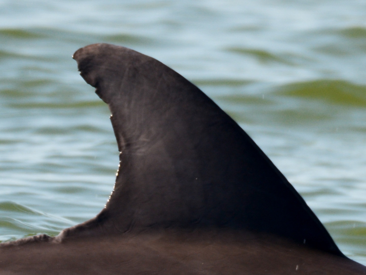
SCARRED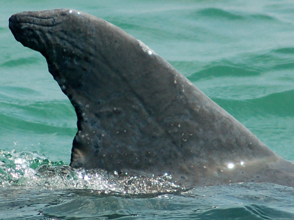
INTACT FINS
ENTIRE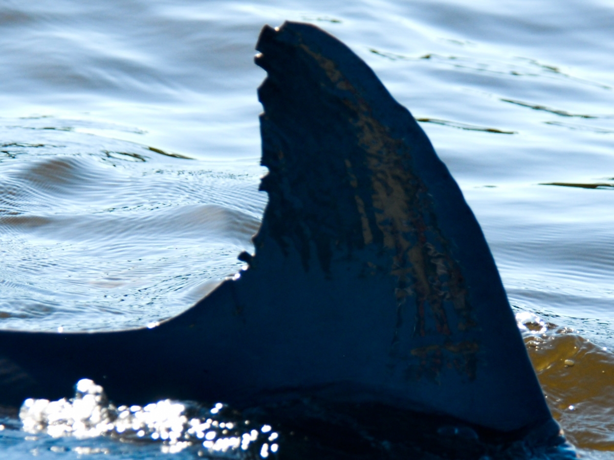
EXTENDED TIP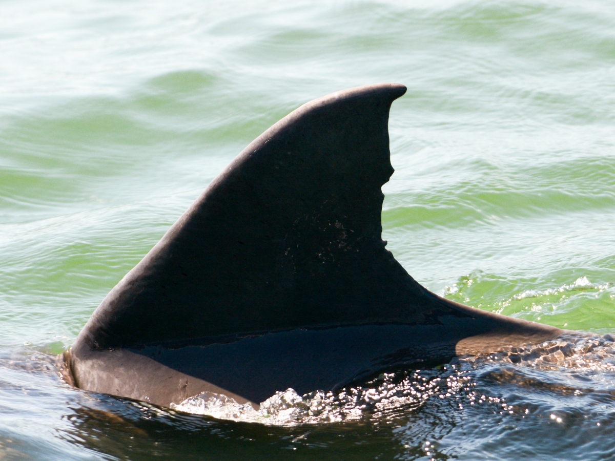
LOWER 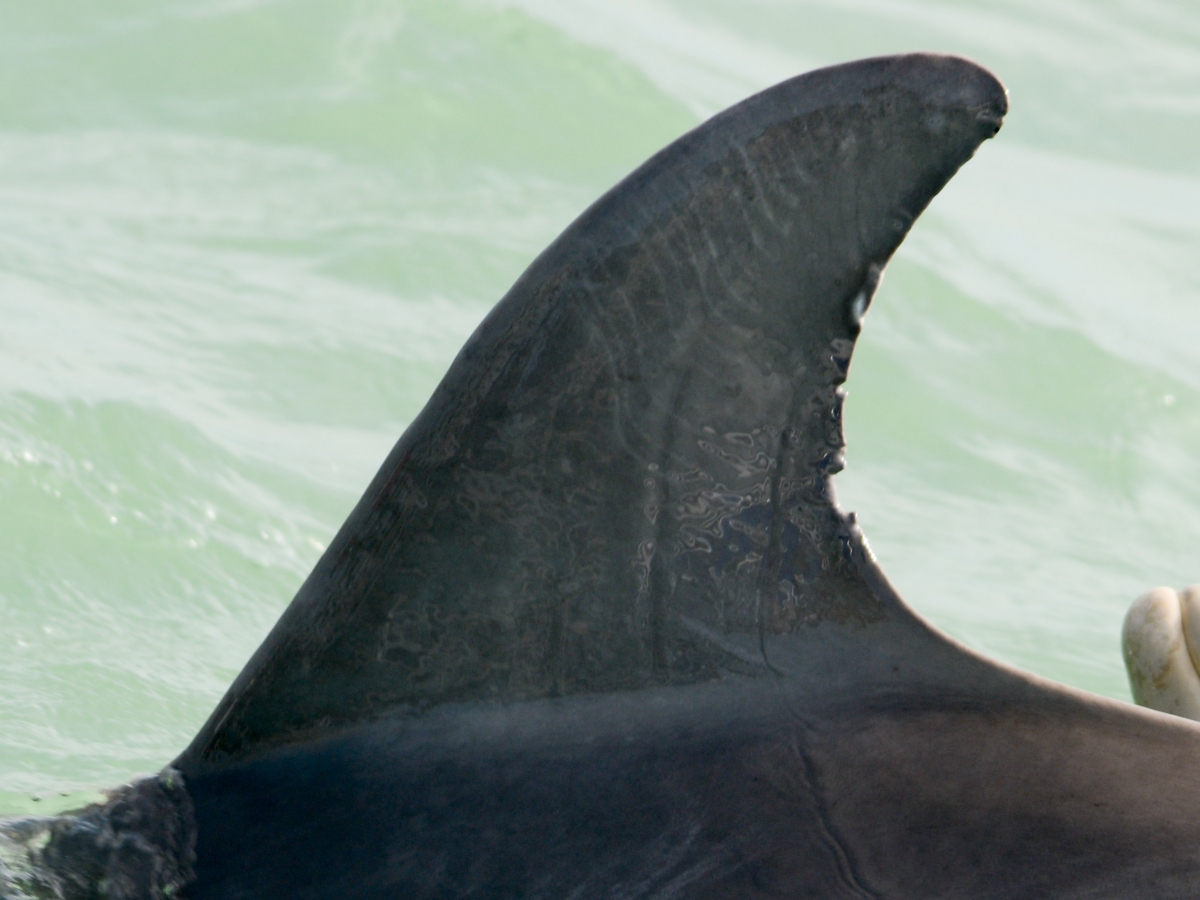
MID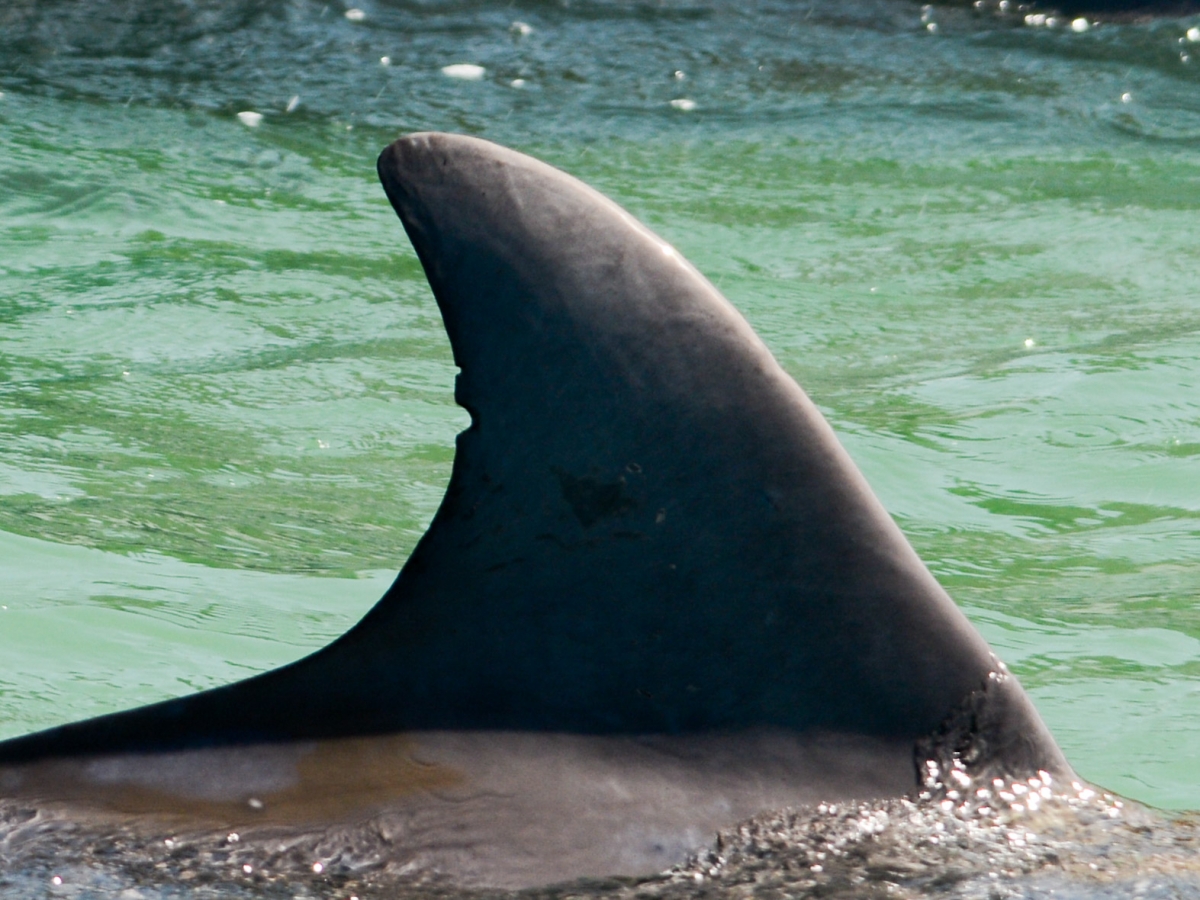
UPPER 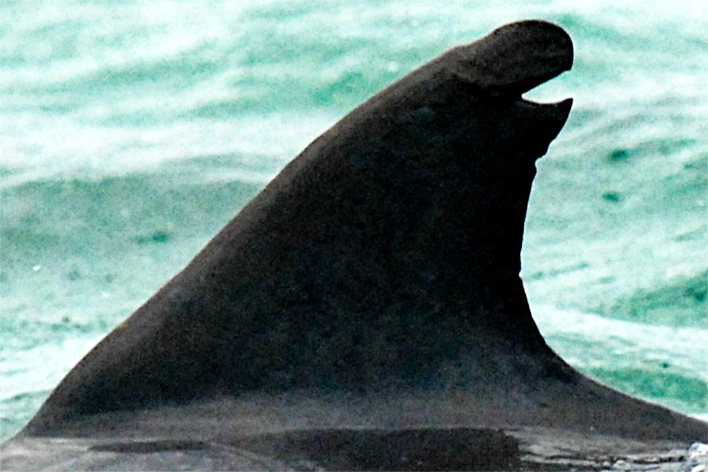
TIP NICK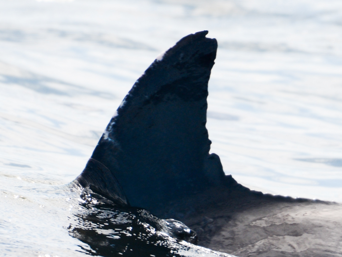
Finally there are those fins that are classified as “Typical”. These have an intact shape with no distinctive characteristics and are not individually identifiable.
In addition to these categories each fin is assigned a color code – Green, Yellow or Red based on the distinctiveness of the feature. These three dolphins all have identifiable features on the upper third of the trailing edge but the severity of the features fall on a scale.
GREEN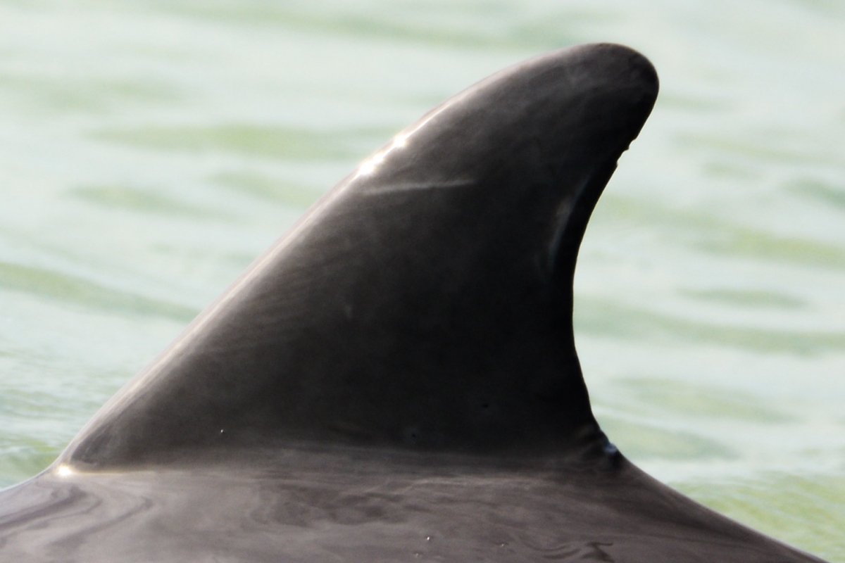
YELLOW
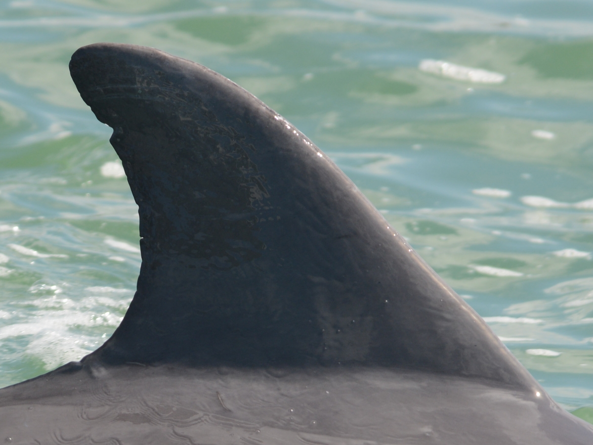
RED
Finally each catalogued dorsal fin photo is assigned one of four survey area tags (Area One -Big Marco pass; Area Two – Open Gulf; Area Three – Naples; Area four – Goodland) based on where they have been sighted.
When trying to determine the identity of a dolphin that appears in one of the sighting photos, the goal is to reduce the possible catalogue matches from over 500 to 1.
The first Step is to screen for dolphins from the survey area(s) where the photo was taken.
Next the search is narrowed to those fin categories that match the unidentified dolphin’s.
Finally those options are further narrowed by screening for the severity of the feature.
If this does not produce a match the procedure is repeated after removing the area filter. At this point if a match has been found the identified dolphin’s name is added to the sighting form. If not the new dolphin is given a name and his profile added to the catalogue. Then it is added to the sighting sheet.
Some photo-identification studies assign a quality grade to each photo based on things like focus and orientation of the dorsal then only include the highest quality photos in their analysis. We have not taken this step. In part, familiarity with many of the dolphins in Area One after years of observation allows us more confidence in identifying individuals using less than optimal photos.
The photos that were used to identify individuals are, however, uploaded with each siting and available to be checked for accuracy.
There are occasions where both observers on the survey team sighted a familiar dolphin during a sighting but, for whatever reason, were not able to capture an image of the dolphin. Those dolphins were included in the sighting report with a note acknowledging a visual sighting without available photo.
Citations
1. Wells, Randall. “Social Structure and LIfe History of Bottlenose Dolphins Near Sarasota Bay, Florida: Insights from Four Decades and Five Generations.” Primates and Cetaceans: Field Research and Conservation of Complex Mammalian Societies, edited by J.Yamagiwa and L. Karczmarski Springer Japan, 2014, p. 156
THE DOLPHIN STUDY
3385 Captains Cove, b
Naples, FL 34112
thedolphinstudy@gmail.com
ABOUT US
THE DATABASE
Images on this site are owned and © by The Dolphin Study Inc. All rights reserved. No images may be taken from this site and used for any purpose without explicit authorization.
The Dolphin Study is a 501(c)(3) Organization – Federal tax ID #83-3170365